Arizona Phoenix Elevation: What You Need to Know About Altitude, Climate, and Travel
If you’re planning a trip, considering a move, or just curious about Arizona geography, you may be wondering about Arizona Phoenix elevation and what it means for weather, health, and daily life. Phoenix is one of the largest cities in the United States, but its elevation is much lower than many other Arizona destinations, which plays a major role in its climate and lifestyle.
This guide explains Phoenix’s altitude, how it compares to other cities, and why elevation matters for visitors and residents alike.
Arizona Phoenix Elevation (Quick Answer)
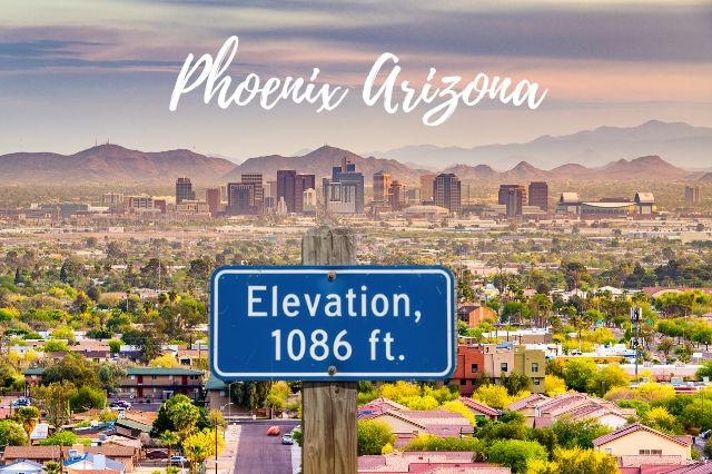
Phoenix, Arizona sits at an elevation of approximately 1,086 feet (331 meters) above sea level.
This relatively low elevation is one of the main reasons Phoenix experiences extremely hot summers compared to other Arizona cities located at higher altitudes.
What Is the Elevation of Phoenix, Arizona?
The official elevation of Phoenix is around 1,086 feet above sea level, although the exact elevation can vary depending on the neighborhood and terrain. Downtown Phoenix sits near this elevation, while some suburban areas and foothill communities are slightly higher.
Phoenix is located in the Salt River Valley, also known as the Valley of the Sun, which is a low desert basin surrounded by mountain ranges. This valley geography contributes to Phoenix’s warm climate and limited cooling from higher elevations.
Is Phoenix Considered High Elevation?
Phoenix is not considered a high-elevation city. High elevation is typically defined as 5,000 feet above sea level or higher, and Phoenix sits far below that threshold.
Many people assume all of Arizona is high elevation, but that is not the case. While cities like Flagstaff and the Grand Canyon sit above 7,000 feet, Phoenix is firmly in the low desert category. This is why Phoenix feels dramatically hotter than northern Arizona and mountain towns.
Weather and Climate Effects
Arizona Phoenix elevation has a direct impact on temperature, weather patterns, and air pressure. Lower elevations generally mean warmer temperatures, and Phoenix is a prime example of this phenomenon.
For every 1,000 feet of elevation gain, temperatures typically drop by about three to five degrees Fahrenheit. Because Phoenix sits just over 1,000 feet, it is significantly warmer than cities like Sedona, Prescott, and Flagstaff, which are thousands of feet higher.
Phoenix’s low elevation also contributes to its desert climate, long summers, mild winters, and intense heat waves. During monsoon season, the surrounding mountains help trigger thunderstorms, but the city itself remains hot due to its valley location.
Phoenix Elevation and Health: What Visitors Should Know
Unlike high-altitude destinations, Phoenix’s elevation is not high enough to cause altitude sickness. Most visitors will not notice any breathing differences related to altitude.
However, the low elevation combined with desert heat means dehydration and sun exposure are common concerns. Visitors should drink plenty of water, wear sunscreen, and limit outdoor activity during peak summer heat.
People coming from high-elevation cities may actually find Phoenix easier to breathe in, although the dry air can feel noticeable at first.
Elevation Differences Across the Phoenix Metro Area
While Phoenix’s average elevation is about 1,086 feet, the broader metro area includes slight variations. Scottsdale, Tempe, Mesa, and Glendale all sit in the low desert but can range from roughly 1,000 to 1,500 feet depending on the terrain.
Areas near South Mountain, the McDowell Mountains, and the Superstition Mountains rise higher, creating scenic views and cooler microclimates. South Mountain itself rises more than 2,000 feet above the city, offering panoramic views of the Valley of the Sun.
Arizona Compared to Other Arizona Cities
Phoenix’s elevation is much lower than many popular Arizona destinations. Sedona sits at around 4,300 feet, which explains its cooler temperatures and pine forests. Flagstaff and the Grand Canyon South Rim sit above 7,000 feet and experience snow and alpine climates. Tucson, another desert city, is higher than Phoenix at roughly 2,400 feet, making it slightly cooler.
These elevation differences are why travelers notice dramatic temperature changes when driving from Phoenix to northern Arizona.
Fun Facts about Geography
Phoenix is one of the lowest major cities in Arizona and one of the hottest large cities in the United States. Even hotter than Southern Arizona. Its location in a desert valley surrounded by mountains creates stunning sunsets, dramatic desert landscapes, and unique hiking opportunities. The city’s elevation also influences real estate development, urban sprawl, and outdoor recreation, with residents often driving to higher elevations for cooler weather.
Arizona Phoenix Elevation FAQs
Is Phoenix at sea level?
No, Phoenix is not at sea level. It sits at about 1,086 feet above sea level.
Is Phoenix higher than Las Vegas?
No, Las Vegas is higher than Phoenix. Las Vegas sits at around 2,030 feet above sea level.
Does Phoenix elevation affect breathing?
Phoenix’s elevation is low enough that most people will not experience breathing issues related to altitude.
Why is Phoenix hotter than Tucson?
Phoenix is lower in elevation and located in a valley, which traps heat more effectively than Tucson’s higher elevation and different geography.
What is the highest point in Phoenix?
South Mountain is one of the highest points within Phoenix city limits, rising over 2,000 feet above the valley floor.
Arizona Phoenix elevation plays a major role in the city’s climate, lifestyle, and travel experience. At just over 1,000 feet above sea level, Phoenix is a low-elevation desert city known for intense heat, mild winters, and stunning desert scenery. Understanding elevation helps explain why Phoenix feels so different from higher-elevation Arizona destinations like Sedona, Flagstaff, and the Grand Canyon.